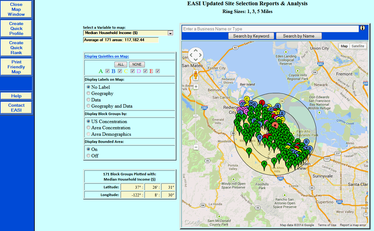
The first step in developing a Site Study Map is to determine which variable from the site selection report is plotted and the options to be used on the map.
Select a Variable to map. Choose the specific variable from the site selection report to plot on the map. All variables in the report are listed in the drop down listing.
Select Map Options:
Select a Variable to map: - Choose the ranking basis for the points plotted on the map.
Display Quintiles on Map: - Each quintile (20% group) will be marked on the map with a corresponding color. Select the quintiles to be included on the map. For example, if only the highest ranking elements are required, uncheck the boxes for B, C, D, and E.
Display Labels on Map - No label simply displays the map with color coded blocks for each quintile. Geography displays the value of the ZIP Code or Block Group associated with each plotted point. Data displays the value of the variable chosen for mapping on each plotted point. Geography and Data displays both the geographic value and the variable value for each plotted point.
Display .... by: - US Concentration ranks the included areas relative to the entire USA. Area Concentration ranks the included areas relative to each other and is a good choice for local analysis. Area Demographics ranks the included areas by their actual values, not their concentrations.
In the left hand navigation area are the following options:
Close Map Window - Returns to the previous page to view the report.
Create Quick Profile - Uses The Right Site's Profile feature to build a profile report for the included areas.
Create Quick Rank - Uses The Right Site's Rank feature to build a rank report for the included areas.
Print Friendly Map - Formats the page for printing using the browser's print button.