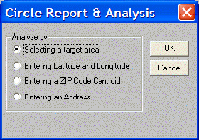
Circle Report & Analysis determines which areas are located within a specified distance of a center point. The center point can be determined using any of four criteria. The analysis is carried out within the Selected Geography (i.e., at the County level).
Selecting a Target Area identifies the center of the circle by name.
Entering Latitude and Longitude identifies the center of the circle by a pair of coordinates.
Entering a ZIP Code Centroid identifies the center of the circle by a ZIP Code centroid, regardless of what the selected geography is. Remember, the centroid is the population centroid, not the physical centroid of the ZIP Code.
Entering an Address identifies the center of the circle by a street address. This feature is only available when the Street Wizard is installed and running with The Right Site.